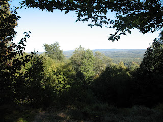
The Maryland highpoint is located conveniently withing a couple of hours from the Pennsylvania HP. This was the first one for me which was accessible by car (finally!). It's part of a mountain ridge that actually have higher points than the Maryland Highpoint, but those are located on the other side of a state border. So to get to the high point the trail actually starts in one state and then you pass by foot into another state, along the way one can also visit a state line marker:
The mountain ridge is quite densely forested, but a clearing have been made in the Maryland direction allowing some decent views close to the marker plaque showing the marker at the Hoye-Crest on the backbone mountain.
Among the more curious things on the route towards the highpoint I can mention that I had to drive through Accident, PA. How anyone could name a town that is beyond me, but it did allow for some amusing signs throughout the town: "General store in Accident", "Auto repairs, Accident" etc.
Stats:
State: Maryland:
High point: Backbone Mountain
Elevation: 3360 ft (1024 m)
Date: 6th September, 2010
Total elevation to date: 9379 ft (2859 m)
Access: Trail (2.2 miles - about 1h)
Difficulty rating (of 10): 3
Potential Difficulties: missing the trail head, trail intersections.


No comments:
Post a Comment